Tel : 0-2653-8255 , 085-121-2301 | Import and distribute Trimble & Nikon

News
Training on Trimble GNSS and WingtraOne Gen II for the Royal Forest Department in Saraburi Province
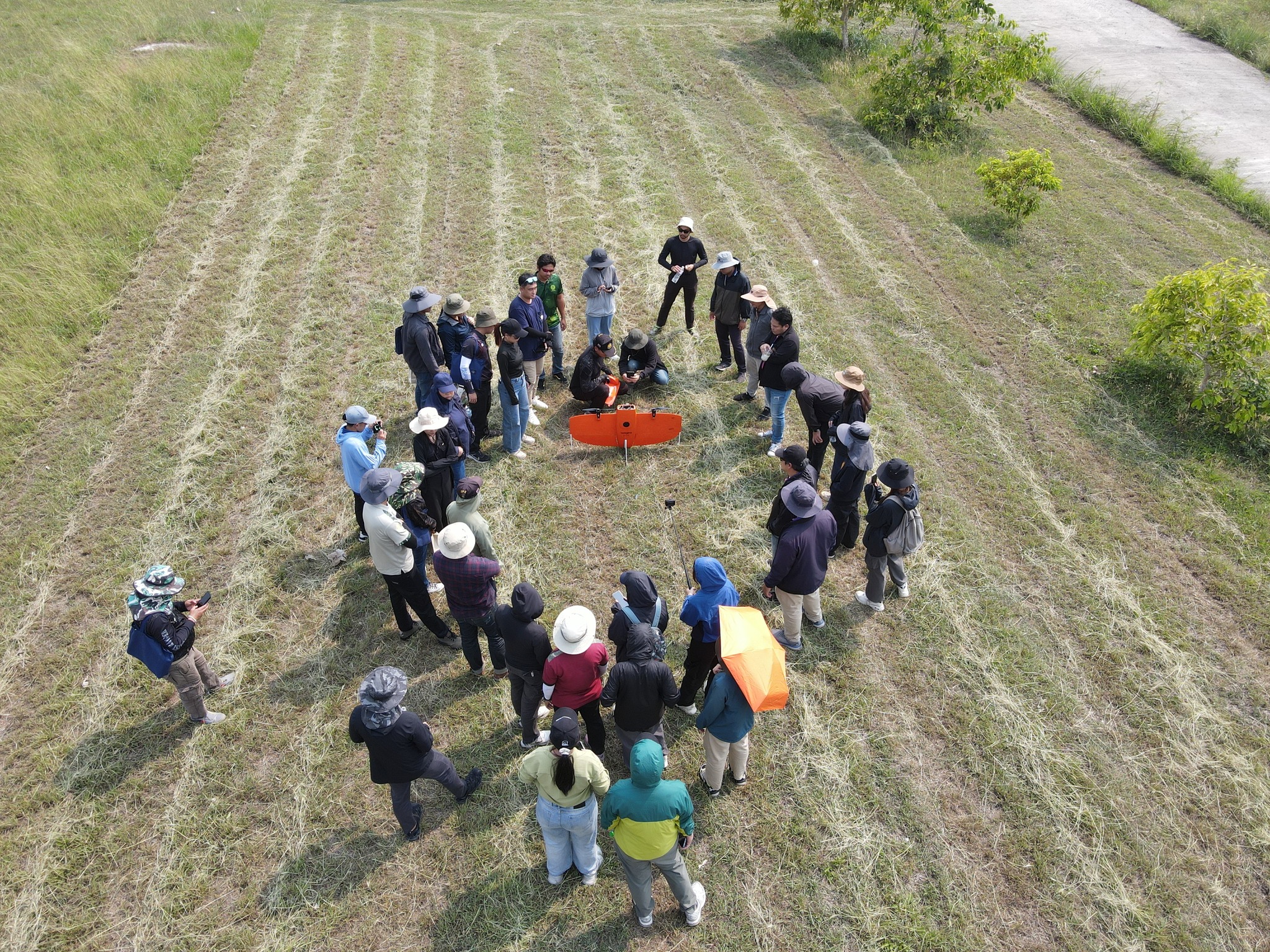
From March 24–28, 2025, the Surveying Instruments Department had the honor of participating in a workshop on the use of Unmanned Aerial Vehicles (UAVs), aerial photogrammetry, and multi-frequency Global Navigation Satellite System (GNSS) receivers. The event was organized as part of the 2025 fiscal year mission of the Forest Land Management Bureau and was held at Sir James Lodge Hotel, Mittraphap Subdistrict, Muak Lek District, Saraburi Province.
Our company’s technical specialists delivered a presentation on the integration of Trimble GNSS surveying systems with the vertical take-off and landing (VTOL) Wingtra UAV for photogrammetric mapping using the Post-Processed Kinematic (PPK) workflow. Participants had the opportunity to gain hands-on experience—starting from flight planning, static GNSS data collection, to data processing. Additionally, a live RTK signal range test demonstrated a communication distance of up to 3.5 kilometers. This practical experience helped build participants’ confidence in using these tools for efficient and accurate forest boundary mapping across the country.
